One mapping mission can return more than a thousand overlapping frames, and a single wedding drone flight can return an hour of 4K video for a three minute highlight film. That gap between flying time and delivery time is why AI tools for drone photographers small business owners choose carefully matter more than the aircraft itself, because the aircraft captures the material and the tools turn it into a product a client will pay for.
The flying is the fast part. Sorting, stitching, grading, and delivering that material is where drone businesses lose days, and it is where the wrong tool choice hurts most. A real estate pilot who buys a heavy survey mapping suite will pay for precision the client never asked for, while an inspection pilot who buys a creative video editor will have beautiful footage and no measurement data.
The nine tools below are organised by the job they do, from flight planning to final delivery, so each pilot type can buy the bottleneck first.
Choosing AI tools for drone photographers small business owners can trust
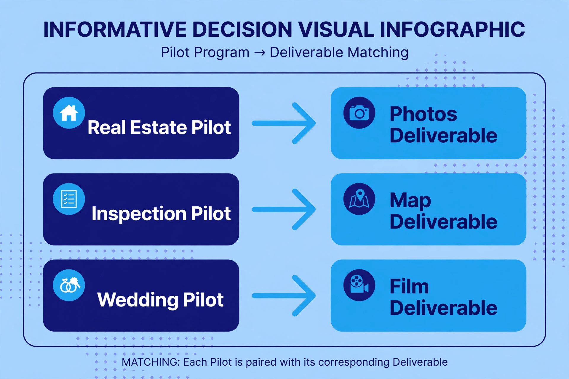
Drone work splits into three different businesses that happen to share an aircraft. A real estate pilot sells beautiful stills and short video that help a listing stand out, and speed of delivery matters more than survey grade accuracy. An inspection pilot sells measurements, defect locations, and repeatable reports, and accuracy and record keeping matter more than cinematic colour. A wedding drone pilot sells a few dramatic shots inside a larger human story, and safety, discretion, and smooth footage matter more than either mapping or measurement.

AI tools for drone photographers small business owners buy should therefore be judged against the pilot job, not against a general best tool list, because a tool that is excellent for one job can be useless for another.
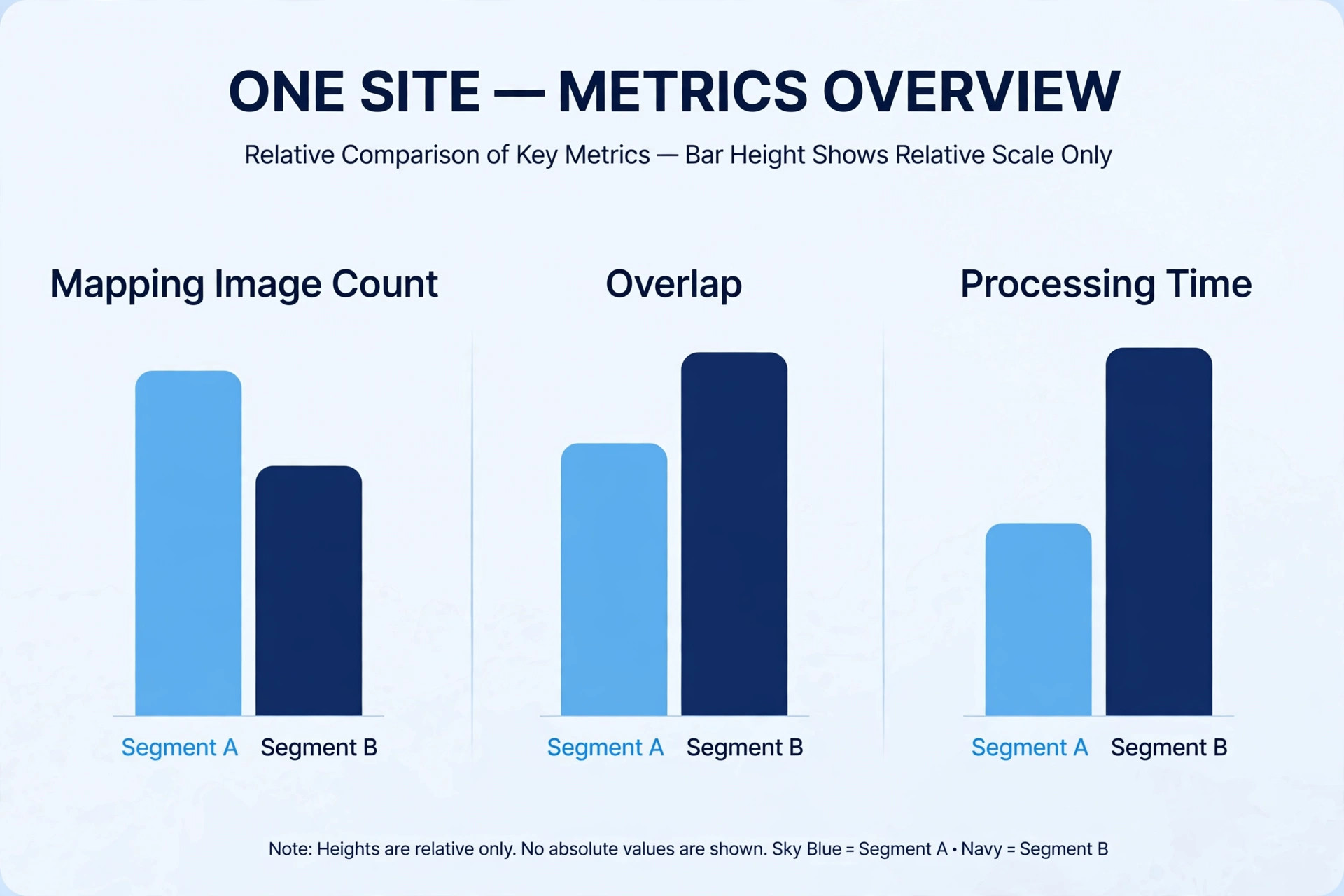
Test any tool on a real paid job before standardising on it, and measure the full chain, from flight time to client delivery time. A mapping tool that processes slowly in the cloud can erase the time saved by an automated flight plan, and a video editor with strong AI grading can still waste hours if its export settings do not match the client delivery format.
Also check drone compatibility before buying, because some tools work best with DJI aircraft and data, others accept files from any manufacturer, and a tool that cannot read your aircraft output is worthless however good its features look. The best pick table below gives each pilot type a starting point, and the tool sections explain what each tool actually does.
| Pilot type | Start with | Add next | Skip for now |
|---|---|---|---|
| Real estate drone pilot | Luminar Neo or AirMagic for fast stills | DaVinci Resolve for listing video | Survey mapping suites until clients ask for measurements |
| Inspection pilot | DroneDeploy or Pix4D for maps and models | FlyPix AI for defect analysis | Cinematic video editors as the main tool |
| Wedding drone pilot | Litchi for planned cinematic shots | DaVinci Resolve for the highlight film | Mapping tools unless venue surveys are sold |
For basic flight skills, read Set Up a Drone for Beginners and for starter aircraft see Best Drone for Beginners Under 300.
1. DroneDeploy
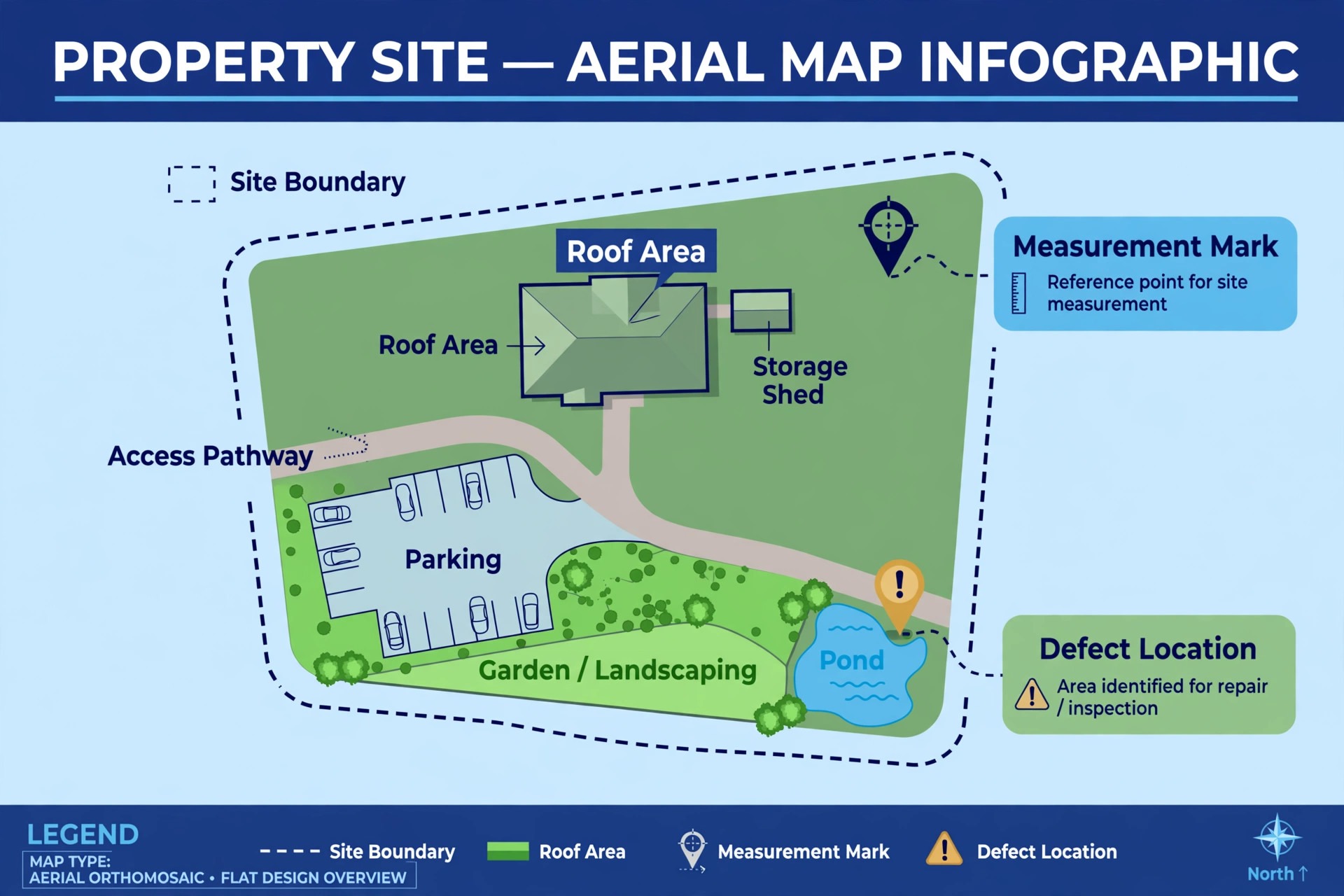
DroneDeploy is a cloud mapping and reality capture platform that turns drone photos into orthomosaic maps, 3D models, point clouds, and progress reports, with AI analysis for site work. Construction, energy, agriculture, and infrastructure teams use it to track progress, measure stockpiles, and compare site conditions over time, and it integrates with tools such as Procore, Autodesk, and Esri ArcGIS. For an inspection pilot, the value is the report, because a client who receives a measurable map with marked locations can act on it without visiting the site, and repeat flights over the same site build a progress record that single photos cannot provide.
DroneDeploy is subscription based with enterprise options, so check the vendor pricing page before buying. It processes in the cloud, which means upload time and connection quality matter, especially for large mapping missions. It is overkill for a real estate pilot who only needs attractive stills, because the mapping workflow adds flight planning, overlap settings, and processing time that a listing shoot does not need. Buy it when clients ask for measurements, maps, or progress documentation, and when the business can charge for that deliverable rather than absorbing mapping time into a photo fee.
2. Pix4D
Pix4D is a photogrammetry software family, best known through Pix4Dmapper, that converts overlapping drone images into 2D maps, 3D models, and point clouds for surveying, construction, and agriculture. Unlike a purely cloud platform, Pix4D offers desktop processing options that keep large datasets local, which suits pilots with slow upload speeds or clients who prefer data to stay in house. Its strength is accuracy and control, with settings for ground control points, coordinate systems, and output formats that survey clients expect, and it supports a wide range of cameras and aircraft beyond a single manufacturer.
Pix4D is sold by subscription and licence depending on the product, so check the vendor pricing page. The learning curve is steeper than a one click mapping app, because accurate outputs need correct flight overlap, correct camera calibration, and correct ground control, and a pilot who skips those steps will produce a pretty model with unreliable measurements. Buy Pix4D when inspection or survey clients need defensible measurements, and pair it with training time, because the software rewards a pilot who understands photogrammetry basics and punishes one who treats mapping as an automatic filter.
3. DJI Terra
DJI Terra is DJI mapping and modelling software that builds 2D orthophotos, 3D models, and digital surface models from visible light and LiDAR data, and it works most smoothly with DJI Enterprise aircraft. Its real time mapping features let a pilot see a growing map during flight, which helps on large sites where coverage gaps are expensive to discover after landing. For inspection pilots already flying DJI Enterprise drones, Terra keeps the whole chain inside one manufacturer ecosystem, from flight app to processing to export, which reduces file conversion problems and support arguments between vendors.
DJI Terra is sold by licence, so check the vendor pricing page. Its limitation is ecosystem fit. A pilot flying mixed fleets or non DJI aircraft will get less from it than a pilot standardised on DJI Enterprise, and a pilot who needs broad third party integrations may prefer DroneDeploy or Pix4D. Buy Terra when the fleet is already DJI Enterprise and the work is mapping, inspection, or LiDAR based, and test it on a real site with the aircraft and sensors the business actually flies, because ecosystem tools shine only when the whole chain matches.
4. Luminar Neo
Luminar Neo is a creative AI photo editor from Skylum that suits real estate drone pilots who need attractive stills fast, with AI sky replacement, relighting, atmosphere controls, and masking that work on aerial images as well as ground photos. A real estate shoot often suffers from flat light, haze, or a dull sky, and Luminar Neo can lift a listing image in minutes without a long Lightroom session. It runs on your own computer, works as a standalone editor or plugin, and keeps files local, which suits a pilot delivering same day listing photos from a laptop.
Luminar Neo is sold by subscription or perpetual licence depending on the current offer, so check the vendor pricing page. It does not map, measure, or stitch, so it is a finishing tool for stills, not a survey tool. The caution for real estate work is honesty. A sky replacement that changes the property appearance, or a colour grade that hides a real defect, can mislead a buyer and create trouble for the listing agent. Enhance light and colour, keep the property itself truthful, and reserve dramatic effects for hero images where the improvement is clearly presentation rather than alteration.
5. AirMagic
AirMagic, also from Skylum, is a dedicated aerial photo editor that applies scene specific corrections for exposure, haze, colour, and contrast to drone photos, with batch processing for a whole flight session and presets tuned to aerial perspectives such as coastal, urban, and golden hour scenes. Its appeal is simplicity. A pilot drags in a session of JPEG files, the AI analyses each shot, and the batch comes out consistently corrected without per image editing. It accepts JPEG, TIFF, and DJI DNG files from any manufacturer, so it suits a pilot flying mixed fleets who wants one simple stills step.
AirMagic is sold as a one time purchase, historically around 39 dollars for a multi device licence, but Skylum now focuses active development on Luminar Neo, so check the vendor page for current availability before buying. That development shift is the main caution. AirMagic still works, but a business buying it today should expect maintenance rather than new features, and should consider Luminar Neo if ongoing updates matter. Buy AirMagic when the job is fast, consistent aerial stills and nothing more, and when a simple batch tool beats a full editor for that workflow.
6. DaVinci Resolve
DaVinci Resolve, from Blackmagic Design, is a full video editor whose Neural Engine provides AI masking, object removal, smart reframing, and scene based grading that suit drone video work. For wedding drone pilots and real estate video pilots, its strengths are colour grading and finishing, because drone footage shot in flat profiles needs careful grading to look cinematic, and Resolve grading tools are stronger than those in most quick editors. Its free version covers a great deal of professional work, with a paid Studio version adding further AI tools and higher end formats, so check the vendor pricing page for the Studio details.
Resolve runs locally, which keeps large video files off slow uploads, but it needs a capable computer, especially for 4K drone footage with AI effects applied. The learning curve is real, and a pilot who only needs short listing clips may finish faster in a simpler editor. Buy Resolve when video is a core deliverable and grading quality justifies the learning time, and learn its delivery presets for each client format, because a beautifully graded film delivered in the wrong codec or aspect ratio still needs rework.
7. Litchi
Litchi is a flight planning app that lets pilots design waypoint missions, orbits, panoramas, and tracking shots on a map before flying, then execute them smoothly in the air. For wedding drone pilots, that planning is the difference between a smooth cinematic orbit around a venue and a shaky manual attempt during a live event. Missions can be rehearsed, adjusted for light and wind, and repeated, which matters when a venue shot must be captured once, during a narrow window, with no second chance. Litchi also supports VR and panorama modes that suit real estate and venue showcase work.
Litchi is sold as a paid app per platform, so check the vendor pricing page. It works with supported DJI aircraft, and compatibility depends on the aircraft model and the current DJI SDK support, so verify your exact aircraft before buying. The safety rule is unchanged by automation. A planned mission still needs a pilot watching the aircraft, the airspace, and the people below, and a mission planned on a map must be checked on site for trees, wires, and changed conditions. Buy Litchi when repeatable cinematic shots are a core product, and plan every mission twice, once on the map and once on site.
8. Airdata UAV
Airdata UAV is a fleet and flight log platform that syncs flight logs, tracks battery health, flags maintenance needs, and provides predictive analytics for flight conditions. For a small drone business, its value is operational rather than creative. A pilot who flies daily for inspections or real estate needs to know which batteries are aging, which aircraft needs service, and whether a planned flight window faces wind or weather problems, and Airdata surfaces those facts before they become a cancelled job or a lost aircraft. It also creates a flight record that supports client reporting and insurance conversations after an incident.
Airdata offers free and paid tiers, so check the vendor pricing page for the tier that matches fleet size. It works by syncing logs from supported flight apps, so check compatibility with the flight app the business actually uses. The limitation is that Airdata manages the operation, it does not edit a single photo or map a single site, so it pairs with the creative and mapping tools rather than replacing them. Buy it when the fleet grows past one aircraft, or when inspection clients start asking for flight records, because at that point manual log tracking becomes a liability.
9. FlyPix AI
FlyPix AI is a geospatial AI platform that analyses drone and satellite imagery to detect objects, monitor changes, and identify anomalies, with tools for training custom AI models on specific detection jobs. For inspection pilots, that analysis turns a map into an answer, such as counting rooftop defects, tracking construction progress, or spotting changes between two flights over the same site. Instead of a human reviewing thousands of frames for a handful of defects, the AI flags candidate locations and the pilot verifies them, which shortens inspection reporting and makes repeat inspections comparable over time.
FlyPix AI is a platform with project based pricing, so check the vendor pricing page before scoping a job around it. Its strength depends on the detection job, because a model trained for one defect type will not reliably find another, and custom training takes example data and review time. It suits inspection businesses that repeat the same analysis across many sites, where the training investment pays back on every later job. It is overkill for a real estate pilot or a wedding pilot, whose deliverable is a beautiful image rather than a counted and located set of findings.
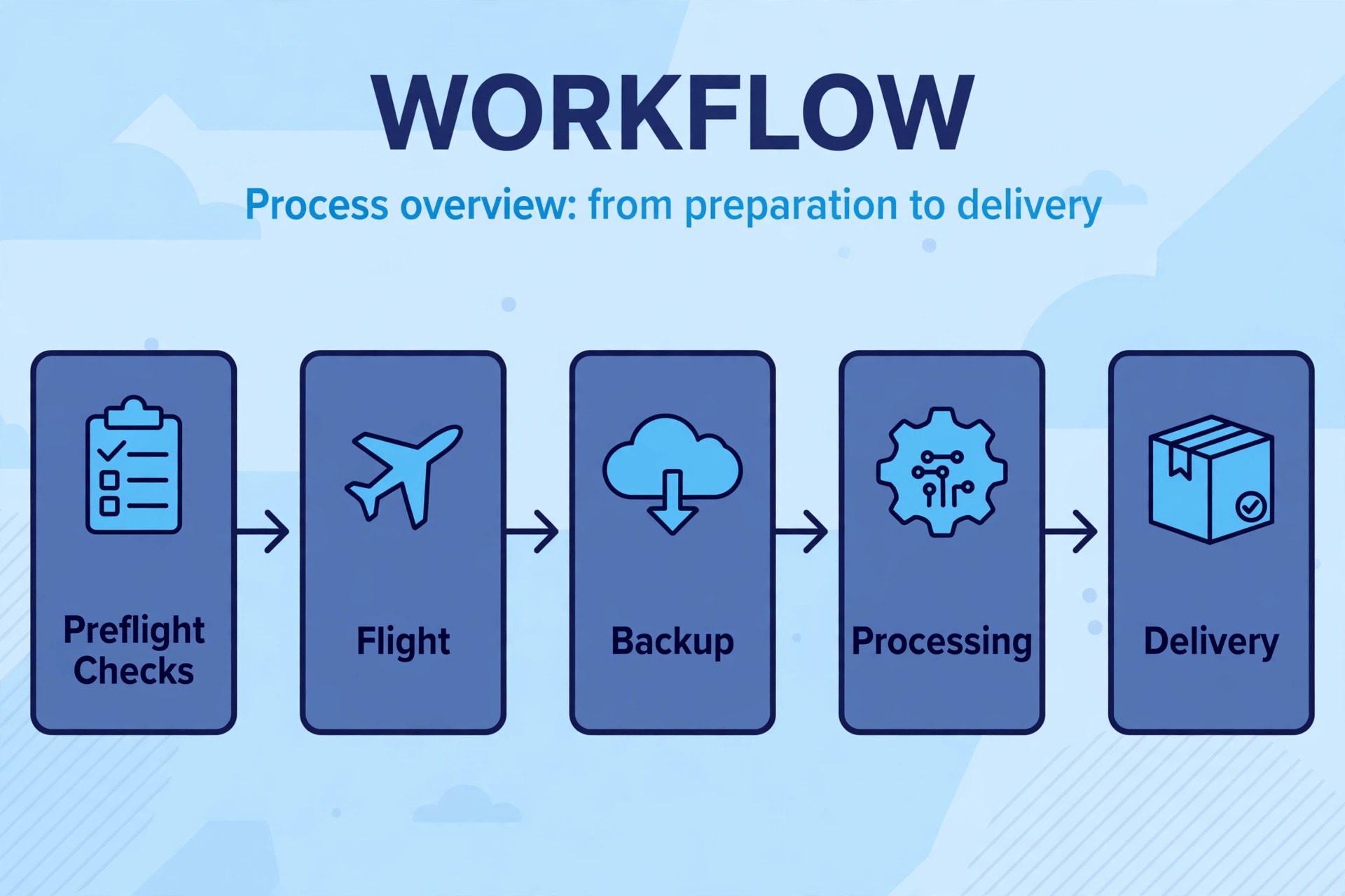
The flight and editing checklist
Every paid drone job should run through the same checklist, because AI tools cannot fix a flight that broke the rules or missed the shot. Before flight, confirm airspace authorisation where required, check weather and wind against the aircraft limits, confirm battery charge and firmware, and walk the site for hazards such as wires, trees, and people. Plan the shots or the mapping grid before takeoff, including overlap settings for mapping jobs and shot lists for creative jobs, because improvising a mapping grid in the air produces gaps that processing cannot fill. During flight, keep visual line of sight, watch battery margins, and record a short test clip or photo to check exposure before committing to a long mission.
After landing, back up cards to two locations before any processing starts, because a lost card loses the whole job. For mapping jobs, check image count, overlap, and coverage before processing, and confirm ground control data is recorded. For creative jobs, review footage on a proper screen, not only on the controller, and select hero shots before grading the full set. For inspection jobs, verify flagged defects against the original frames before reporting them, because an AI detection is a candidate, not a confirmed finding.
AI tools for drone photographers small business owners use well shorten the middle of this chain, from raw material to deliverable, but they do not replace the checks at either end, and the checks are what keep clients trusting the result.
Airspace, safety, and client honesty
Drone rules vary by country and change over time, so treat this section as a prompt to check current rules, not as legal advice. In the United States, commercial drone work generally falls under FAA Part 107 rules, which include pilot certification, airspace authorisation through systems such as LAANC where available, and limits on flying over people, at night, and beyond visual line of sight without special permission. Other countries have their own equivalents, and a pilot working near airports, crowds, or controlled airspace must check the local system before every job. An AI flight planning tool does not grant airspace permission, and a beautiful planned orbit over a restricted area is still a restricted flight.
Client honesty matters as much as legal compliance. Tell real estate clients what was enhanced in their listing images, tell inspection clients the accuracy limits of a map made without ground control, and tell wedding clients the conditions under which drone shots cannot happen, such as high wind, rain, or a venue that bans drones. A pilot who promises drone coverage unconditionally will eventually face a wedding day when wind grounds the aircraft, and the client disappointment will be worse for the unconditional promise. Write drone conditions into the booking terms, name a backup plan for grounded days, and keep the drone as a bonus inside a larger photography or inspection package rather than the only reason the client booked.

Mistakes that cost drone pilots money
The most expensive mistake is buying a mapping suite for a photography business, or a creative editor for an inspection business, because the tool and the deliverable do not match. Map the deliverable first, then buy the tool that produces it, and refuse tools that solve a problem the clients never asked about. The second mistake is undercharging for processing time. A mapping job that takes thirty minutes to fly and four hours to process and report is a four and a half hour job, and pricing it as a thirty minute flight guarantees losses. Price the full chain, including processing, review, and reporting, and show the client the deliverable that justifies that price.
The third mistake is skipping the coverage check on mapping jobs. A map with a gap over the exact area the client cares about cannot be fixed by AI, and a return flight costs more than a careful preflight grid check. The fourth mistake is over grading real estate and wedding footage until it looks unlike the place itself, because clients notice the difference on arrival and blame the pilot for the gap between image and reality.
The fifth mistake is neglecting fleet records, because a battery failure or a maintenance gap discovered during a paid job costs a client and a reputation at once. AI tools for drone photographers small business owners keep for years are the ones matched to a priced deliverable, checked before delivery, and supported by honest client terms.

Building a drone service menu clients understand
Clients do not buy software, they buy deliverables, so a drone service menu should list deliverables with plain names and plain prices. A real estate menu might list a stills package, a stills plus short video package, and a premium package with twilight style edits and a venue showcase clip. An inspection menu might list a photo survey, a mapped survey with measurements, and a repeat monitoring package with change reports across flights.
A wedding menu might list drone coverage as an add on to a photography package, with named conditions for weather and venue rules, rather than as a standalone promise. Each menu item should state what the client receives, in what format, and by what date, because vague deliverables produce vague satisfaction.
Pricing the menu means pricing the full chain, and AI tools for drone photographers small business owners adopt change that chain in uneven ways. A mapping tool may cut processing time in half but add a subscription cost and upload time, while a video editor may cost nothing but demand a faster computer. Record flight time, processing time, review time, and delivery time for the first ten jobs of each menu item, then set prices from those records rather than from competitor headlines.
Review the menu quarterly, retire items nobody buys, and promote the item with the best margin and the happiest clients, because a menu that grows without pruning eventually confuses buyers and fills the diary with the least profitable work.
The menu also protects the pilot when a job goes wrong. When drone coverage is one item on a clear menu with stated conditions, a grounded wedding flight becomes a substituted item rather than a broken promise, and a mapping gap becomes a defined rework rather than an open ended complaint. AI tools for drone photographers small business owners rely on should make each menu item faster or more accurate, and any tool that does neither should leave the stack, however impressive its demonstration looked. Write the menu before buying the next tool, and let the menu decide which tool earns a place.
Frequently Asked Questions
What is the best AI tool for a real estate drone pilot?
Start with a fast stills editor such as Luminar Neo or AirMagic, plus a simple video editor for listing clips, because real estate clients buy attractive images and quick delivery, not survey data. Add a flight planning app such as Litchi when cinematic venue shots become a regular request. Move to mapping tools only when a client asks for measurements or site documentation, because mapping adds flight planning and processing time that a listing fee may not cover.
Can a small drone business do mapping without survey training?
A small business can produce maps and models with tools such as DroneDeploy or Pix4D, but measurement accuracy depends on flight overlap, camera calibration, and ground control, not only on software. For marketing maps and progress visuals, a careful pilot can deliver useful results. For boundary, engineering, or legal decisions, clients need survey grade work from qualified surveyors, and a drone pilot should say so plainly rather than implying a marketing map carries survey authority. Honest limits protect both the pilot and the client.
How much should a drone pilot charge for processing time?
Charge for the full chain, including flight, processing, review, reporting, and delivery, because processing often takes longer than flying. A mapping job, an inspection report, and a graded wedding film each carry different processing loads, so price each deliverable separately rather than charging a single flight fee. Record actual processing time for the first ten jobs of each type, then set prices from those records, and review them quarterly, because faster tools and larger datasets both change the processing cost over time.
Is cloud processing a problem for large drone datasets?
Cloud processing can be slow when upload speeds are limited and datasets are large, which is common for mapping missions with thousands of images. Desktop processing options, as in Pix4D and DaVinci Resolve, keep large datasets local and avoid upload delays, while cloud platforms such as DroneDeploy offer collaboration and reporting features that desktop tools may lack. Choose based on dataset size, connection quality, and client collaboration needs, and test the full upload and processing chain on a real job before promising a delivery time.
Do wedding venues allow drone flights?
Some venues allow drones, some restrict them, and some ban them entirely, so check with the venue before promising drone coverage. Even where drones are allowed, wind, rain, crowds, and nearby airspace can ground a flight on the day, so booking terms should name a backup plan and avoid guaranteeing drone shots unconditionally. A pilot who checks venue rules early, plans shots around the ceremony schedule, and keeps drone work discreet during quiet moments will keep more venue relationships than one who treats every wedding as a drone showcase.
What is the difference between DroneDeploy and Pix4D?
DroneDeploy is a cloud platform built around maps, models, progress tracking, and team reporting, with integrations for construction workflows, while Pix4D is a photogrammetry software family with desktop processing options and deeper control over accuracy settings and outputs. A team that needs cloud collaboration and progress reporting may prefer DroneDeploy, while a pilot who needs local processing, survey control, or mixed fleet support may prefer Pix4D. Test both on the same site when possible, and choose based on the deliverable the clients actually buy.
The Drone Photographer Verdict
Match the tool to the pilot job, price the full chain from flight to delivery, and check every AI result before it reaches a client. That discipline is what makes AI tools for drone photographers small business owners can build a lasting service around, rather than a collection of subscriptions that outlive their usefulness. A real estate pilot will likely land on fast stills editing plus simple video, an inspection pilot on mapping plus analysis, and a wedding pilot on planned cinematic shots plus careful grading.
Whichever stack you choose, keep the flight checklist, the coverage check, and the client honesty terms in place, because those habits protect the business more than any single feature. AI tools for drone photographers small business owners buy should remove hours from processing and reporting, not add subscriptions for problems the clients never asked to solve.